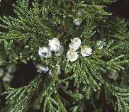
Atlantic White-Cedar cones

On-line Proceedings of the
2009 Atlantic White-Cedar Symposium

The Ecology and Management of
Atlantic White-Cedar (Chamaecyparis thyoides) Ecosystems

A Symposium held on June 9, 10, and 11, 2009 at the
City Hotel and Bistro in Greenville, North Carolina - USA


Table of Contents and Conference LInks

Sea Level Rise Risk Assessment for the Dare County Peninsula

Robert Mickler and David Welch, Alion Science and Technology; Kevin Bigsby and Heather Cheshire, North Carolina State University, Department of Forestry and Environmental Resources

Presented by Robert Mickler

Coastal North Carolina has been identified as one of the most vulnerable regions to climate change in the US. More than 2,000 square miles of North Carolina's coastal ecosystems and urban areas are below one-meter elevation. The Sea Level Affecting Marsh Model (SLAMM) was used to generate a range of best to worst case sea level rise predictions for the Dare County peninsula and surrounding areas at 10 year intervals from 1982 to 2100. Light Detection and Ranging (LIDAR) data was obtained from the NC Floodplain Mapping Program to produce a digital elevation model (DEM) and the National Wetlands Inventory was used to determine the type and extent of initial vegetation classes. Sea level rise scenarios from the IPCC, 2007 report were used to generate a range of sea level rise predictions to 2100. SLAMM was used to simulate the dominant processes involved in wetland conversions and shoreline modification during long-term sea level rise. Model processes include: inundation (based on the minimum elevation and slope), erosion (based on maximum fetch threshold and proximity of the marsh to estuarine water or open ocean), overwash (at a fixed storm intervals to estimate beach migration and transport of sediments), saturation (migration of coastal swamps and fresh marshes onto adjacent uplands), and accretion (vertical rise of marsh due to buildup of organic and inorganic matter on the marsh surface). The sea level rise scenarios will be used to produce GIS maps of area inundated and natural and cultural resources affected by inundation. Maps and tabular data have been constructed at ten year time intervals for the Dare County Peninsula and surrounding area to 2100. Each area has been assessed for proposed land and vegetation management recommendations to mitigate for sea level rise.

Proceedings Table of Contents and Conference Links