
Water Quality - Pocosin Lakes National Wildlife Refuge
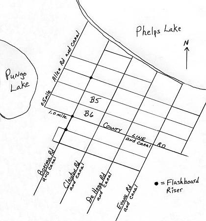
Map of portion of Pocosin Lakes NWR (Washington Co., N. C.) south of Phelps Lake. The area was ditched and drained for agriculture between 1950 and the late 1980s, and is now part of a wetlands restoration project. The study area contained 640 acres (two 320-acre blocks, indicated by asterisks), and was bounded by County Line Rd (south), Clayton Rd (east), Boerma Rd (west), and a large canal (north). The soil series was Pungo, with peat averaging about 7-9 ft deep.
< Previous Next >
Return to outline
For additional information on this web page contact Mike Wicker at mike_wicker@fws.gov.
Visit the North Carolina Ecological
Services Home Page
Visit the U.S. Fish and Wildlife Service
Home Page